Segment Area
Segment Areas are uniquely defined (and required) by the following parameters:
- Segment area name - user defined descriptive name of location
- Start time - typically the date and time of the first record of data at this location
- City
- County
- State
- Functional classification
- Route sign number - if unknown then 0
- Organization - organization or agency leading the count effort
Additional parameters include:
- speed limit
- national highway
- usbrid - US Bicycle Route System ID
- observed land use
A Segment Area cannot have more than one functional classification.
A typical Segment Area extends along a road or pathway until a user is able to change their direction of travel, unless the Segment Area is part of an intersection count (see below). A Segment Area is composed of all Facilities, Detectors, Flows, and Flow Detectors.
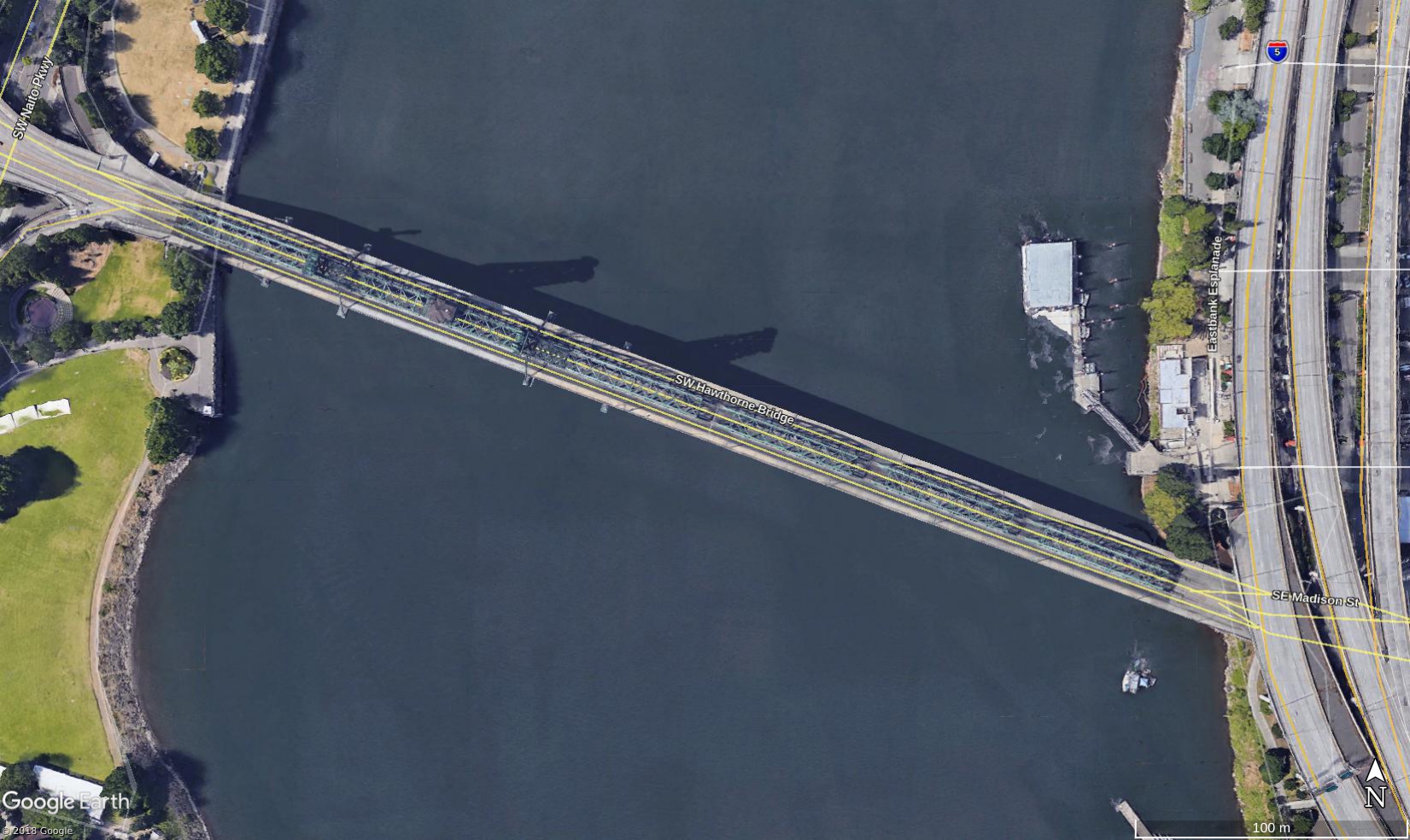
Example 1
If counts are being recorded on either side and both directions on Hawthorne Bridge the Segment Area is “Hawthorne Bridge” (Fig. 1).
Intersections
The name of the segment should start with the road name from where the count originates. The second part of the segment name is the road name of the intersection. There are several instances where an intersection can have more than two unique Segment Areas.
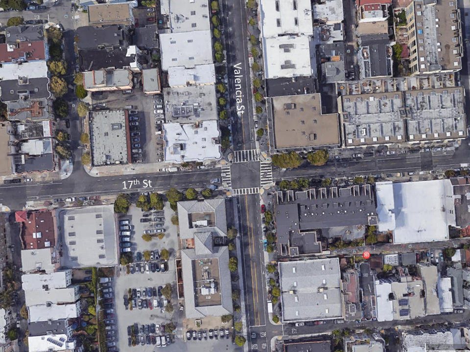
Example 2
There are two Segment Areas at the intersection of 17th St and Valencia St. If bicyclists are being counted on Valencia St either continuing travel on Valencia St or turning onto 17th St. The Segment Area Name would be “Valencia St & 17th St” (Fig. 2). If bicyclists are being counted on 17th St and are either continuing to travel on 17th St or turning onto Valencia St, the Segment Area Name would be “17th St & Valencia St”.
Example 3
There are three Segment Areas at the intersection of Circle Blvd and Kings Blvd because the Functional Classification of Circle Blvd changes from “Minor Collector” to “Minor Arterial” (Fig. 3).
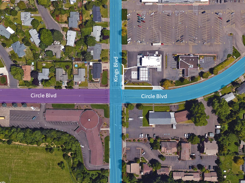
The name of the segment should start with the road name from where the count originates and include the functional classifcation in parentheses. The second part of the segment name is the road name of the intersection. The three segment names for Example 2 are:
- Circle Blvd (Minor Arterial) & Kings Blvd
- Circle Blvd (Major Collector) & Kings Blvd
- Kings Blvd & Circle Blvd
Example 4
There are 12 Segment Areas where 8th St, Townsend St, Division St, and Henry Adams St intersect around a roundabout. Division St and Townsend St are both “Major Collectors”, 8th St is a “Minor Arterial”, and Henry Adams St is a “Local” road (Fig. 4).
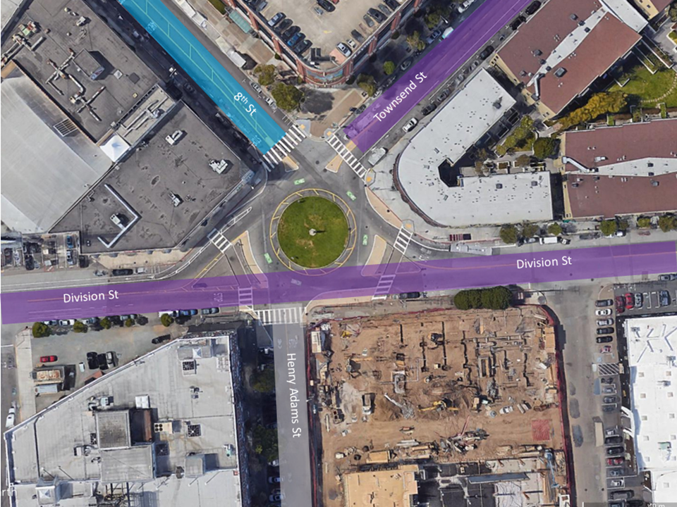
The 12 segment names for Example 3 are:
- Division St & Henry Adams St
- Division St & Townsend St
- Division St & 8th St
- Henry Adams St & Division St
- Henry Adams St & Townsend St
- Henry Adams St & 8th St
- Townsend St & 8th St
- Townsend St & Division St
- Townsend St & Henry Adams St
- 8th St & Townsend St
- 8th St & Division St
- 8th St & Henry Adams St
Additional exceptions: If there is an intersection where the name changes after an intersection following the same flow of traffic creating a separate Segment Area is recommended to avoid confusion when creating and uploading metadata or count data. In addition, if there is an intersection where a bicyclist or pedestrian can turn in the same flow direction but onto two different facilities (insert figure here of trail versus street), creating a separate Segment Area is also recommended to avoid confusion.